
The Evolution of Drone Technology: Embracing AI and Computer Vision in 2024
In 2023, the integration of AI and computer vision into drone technology has catalyzed a monumental shift in autonomous capabilities. This advancement is anchored in sophisticated machine learning algorithms, which enable drones to interpret and respond to their environments with an unprecedented level of precision. The synergy between artificial intelligence and a vision platform like the computer vision platform of visionplatform.ai has been pivotal in enhancing the functional scope of drones, propelling them far beyond their traditional roles.
The role of computer vision software in drones has been transformative, allowing for real-time detection and object mapping, crucial for various applications. Drones now process an immense amount of data from their sensors, leading to more informed and autonomous decision-making. In search and rescue operations, for instance, this advancement allows drones such as DJI drone dock to autonomously navigate challenging environments, swiftly locating and assisting in emergency scenarios.
Moreover, 2023 has seen these UAVs leverage artificial intelligence for improved aerial navigation, boosting their efficiency in tasks like mapping and monitoring. The incorporation of AI in drones also entails the use of sophisticated learning algorithms, further refining their detection and tracking capabilities. This evolution represents a significant leap in drone data technology, marking a new era of autonomous and intelligent aerial solutions.
Python: The Driving Force Behind AI in Drones
In the rapidly evolving world of drone technology, Python has emerged as a key player in the development of AI-driven applications for UAVs. Recognized for its simplicity and adaptability, Python is the preferred programming language for crafting learning algorithms that power the AI in drones. In 2023, Python’s role in drone AI development is more pivotal than ever, enabling the creation of complex algorithms that allow drones to intelligently interpret and interact with their surroundings.
Python’s extensive libraries and frameworks, particularly in machine learning and computer vision like TensorFlow and OpenCV, have streamlined the implementation of complex algorithms in drones to get more work done. These tools facilitate efficient processing of large amounts of data collected by drone sensors, enabling real-time analysis and decision-making. This capability is vital in scenarios requiring immediate responses, such as emergency situations where timely action is crucial.
Furthermore, Python’s compatibility with various AI and machine learning frameworks has made it an ideal choice for developing autonomous navigation systems in drones. These systems heavily rely on algorithms that process sensor data to detect obstacles and determine optimal flight paths, ensuring safe and efficient operations. The integration of Python in drone AI not only enhances their navigational abilities but also broadens their potential applications across various domains, from aerial surveying to urban planning.
In conclusion, the collaboration of Python with AI and machine learning algorithms is fundamental in advancing drone capabilities. This partnership sets new standards in autonomous and intelligent drone operations, underscoring the importance of Python in the future of drone technology.
Navigating the Skies: Autonomous Drone Navigation
In 2023, autonomous navigation in UAVs has reached new heights, primarily due to advancements in AI, computer vision and edge computing. A key aspect of this evolution is the implementation of OpenCV, a library that has become indispensable in the development of real-time image processing and video processing and navigation algorithms. This tool enables drones to process an immense amount of data from aerial environments, allowing for precise and autonomous navigation.
The usage of OpenCV in drone technology facilitates real-time analysis of aerial data, crucial for UAVs to autonomously adapt to changing environments. This feature is particularly valuable in complex scenarios like emergency response, where drones must navigate quickly and accurately to provide assistance. By analyzing data autonomously, drones can identify the best routes, avoid obstacles, and reach destinations faster, proving indispensable in time-sensitive situations.
Furthermore, the integration of machine learning algorithms with OpenCV has significantly enhanced the autonomous navigation capabilities of drones. These algorithms process the large amount of data collected by sensors, enabling UAVs to make informed decisions swiftly. The result is a generation of drones that can not only navigate autonomously but also adapt to new challenges in real-time, showcasing the remarkable potential of AI in aerial technology.
Enhancing Security and Surveillance with AI-Powered Drones
In the realm of security and surveillance, AI-powered drones have become a game-changer. The incorporation of machine learning algorithms and computer vision tools and drone technology into UAVs has dramatically enhanced their capability to autonomously perform surveillance and security tasks. In 2023, these drones are increasingly being deployed for real-time monitoring and emergency response, thanks to their ability to autonomously process a vast amount of data and provide actionable insights.
The use of OpenCV in these drones has been pivotal in enabling real-time detection and tracking, a critical aspect of surveillance operations. This technology allows drones to autonomously navigate complex environments and identify potential security threats or emergency situations quickly. The data processed by these drones, often in challenging aerial environments, provides invaluable insights for maintaining security and responding to emergencies efficiently.
Moreover, the advancement in machine learning algorithms has empowered drones to not only gather data but also interpret it autonomously. This capability ensures that drones can be deployed in diverse security scenarios, from urban surveillance to border security, and operate effectively without constant human oversight. The result is a more robust, responsive, and efficient security apparatus, where AI-powered UAVs play a central role in safeguarding people and property.
These developments in drone navigation and security applications demonstrate the profound impact of AI, OpenCV, and machine learning on the capabilities and functionalities of UAVs in various sectors.
Autonomous Algorithms: The Brains Behind Drone Intelligence
In the rapidly advancing drone industry, computer vision and machine learning are the driving forces behind the intelligence of autonomous drones. Drones with computer vision, powered by sophisticated computer vision algorithms, are revolutionizing how they understand and interact with their surroundings. Integrating computer vision in drone technology has enabled these machines to autonomously perform complex tasks, such as obstacle avoidance and navigation without human intervention.
The development of drone programming with computer vision has been instrumental in enhancing the functionalities of drones. For instance, drones are used in security and surveillance by employing computer vision technology to monitor and analyze visual data in real-time. The Tello or DJI M300 drone, a prominent example in the drone industry, exemplifies how computer vision models, combined with deep learning algorithms, can empower drones to perform tasks like capturing digital images and videos of the environment and processing them to gather valuable insights.
Moreover, the application of computer vision in drones extends beyond mere image capture; drones also utilize AI technology to identify obstacles and objects of interest during their missions. This advancement is particularly significant in sectors like military drones, where precision and real-time decision-making are critical. As technology advances, drones are becoming more adept at understanding complex scenarios and responding autonomously, marking a significant milestone in the union of drones and computer vision.
OpenCV and Real-Time Processing in Drones
OpenCV, a fundamental tool in computer vision technology, plays a crucial role in the real-time processing capabilities of drones. The integration of OpenCV in drones enables them to process a large amount of visual data swiftly, enhancing their ability to understand and interact with their environment in real-time. This feature is vital in applications where drones need to capture and identify obstacles in real-time and dodge them effectively.
In the context of drone control, OpenCV facilitates the development of more sophisticated and responsive systems. Drones equipped with OpenCV can autonomously navigate complex environments, flying with precision and avoiding obstacles without the need for human guidance. This autonomy is particularly useful in drones used for search and rescue missions, where the ability to quickly process visual information and provide valuable insights can be life-saving.
Furthermore, drones that are used in manufacturing and industrial settings benefit from OpenCV’s real-time processing. These drones can fly over areas like power lines or large industrial facilities, capturing 720p camera images and videos, and processing them on-the-fly to identify structural issues or maintenance needs. The use of OpenCV in drones has also facilitated the creation of 3D models of structures and landscapes, which are created by drones capturing multiple images from different angles.
In summary, OpenCV’s integration into drones enhances their capabilities to autonomously and intelligently navigate and perform tasks, redefining the potential of unmanned aerial vehicles in various sectors. This technology underscores the importance of real-time data processing in the expanding scope of AI drone applications.
Exploring the Tello Drone: A Case Study in Computer Vision
The Tello drone stands as a prime example of the advancements in computer vision for drones. Drones like Tello have revolutionized how tasks are accomplished, offering flexibility and efficiency previously unattainable. These drones provide invaluable services across various sectors, with their ability to capture high-quality digital images and videos and process them in real-time, enhancing their functionality significantly.
In the realm of military drones, the Tello and similar UAVs demonstrate their prowess. Equipped with thermal cameras and advanced navigation systems, these drones can fly autonomously, identifying obstacles and navigating complex environments with minimal need for human intervention. This capability is especially crucial in drone missions where safety and precision are paramount.
Moreover, the Tello drone utilizes Jetson technology, underscoring the technological advances in the drone industry. This allows for more complex operations, such as creating 3D models of landscapes and structures, all done autonomously by drones. These models are invaluable in sectors like architecture and urban planning, where detailed and accurate representations of the environment are essential.
Object Detection and Mapping: Expanding Drone Horizons
The integration of computer vision into drones has significantly enhanced their capability in object detection and mapping. Drones are used extensively in search and rescue missions, where they provide valuable insights that aid in locating individuals in distress. This is made possible by their advanced computer vision systems, which can interact with their surroundings, quickly identifying obstacles and areas of interest.
Annotation for drone training is a critical process in preparing these UAVs for complex tasks. By annotating images and videos captured by drones, machine learning algorithms can learn to detect and differentiate between various elements in their environment. This process ensures that drones can perform tasks such as identifying power lines or other critical infrastructure efficiently.
The use of drones for object detection and mapping has seen a surge across many sectors that resort to UAV technology to get more work done in a shorter period of time. Examples of industries that lean on this technology include agriculture for crop monitoring, urban development for mapping projects, and environmental conservation for tracking changes in ecosystems.
In summary, the application of computer vision in drones like the Tello has not only expanded their operational capabilities but also opened up new possibilities in various industries. These advancements highlight how drones, once simple flying machines, have evolved into intelligent tools capable of performing complex tasks autonomously and efficiently.
Building Comprehensive Computer Vision Systems for UAVs
The development of comprehensive computer vision systems in UAVs is a topic highly recommended by experts on platforms like Medium, particularly for its significance in the drone industry. These systems include an array of sensors and cameras, backed by powerful processing units, enabling drones to undertake more complex tasks than ever before. Many sectors resort to these advanced UAVs, leveraging their enhanced capabilities for various applications.
For instance, in agriculture, drones equipped with these systems can monitor crop health over large areas, accomplishing this task in a much shorter period of time compared to traditional methods. Similarly, in urban planning, drones are used for creating detailed 3D maps, a task that would take considerably longer if done manually. This efficiency is crucial in scenarios where time is of the essence, such as during emergency responses or rapid environmental assessments.
The flexibility of these systems allows them to be tailored to specific industry needs. Examples of industries that lean heavily on drone technology include construction for site surveys, forestry for wildlife monitoring, and environmental science for tracking climate change impacts. These sectors benefit significantly from the ability of drones to gather and process data quickly, providing valuable insights that drive decision-making.
The Importance of Annotation for Drone Training
Annotation for drone training plays a crucial role in enhancing the capabilities of UAVs, particularly in complex computer vision applications. This process involves labeling images and videos captured by drones, which is essential for training machine learning models to accurately interpret and respond to visual data. Systems that include these well-trained models can be used for more intricate and nuanced tasks, a key factor in the expanding utility of drones across various industries.
Many sectors resort to drones to perform tasks that were previously unfeasible or would have been done in a much longer period. For example, in wildlife conservation, drones with advanced computer vision can identify and track animal species in their natural habitats, providing researchers with detailed insights without disturbing the ecosystem. Similarly, in emergency services, drones expedited search and rescue missions, locating individuals in distress more swiftly than conventional methods.
These examples underscore the importance of accurate annotation in drone training, as the reliability of UAV operations heavily relies on the quality of the training data. By ensuring that drones are trained with accurately annotated data, industries can maximize the potential of UAV technology, achieving tasks more efficiently and effectively.
Advanced Detection and Tracking with Drone Technology
The field of drone technology has made significant strides in advanced detection and tracking capabilities. These advancements have been largely propelled by the integration of sophisticated computer vision algorithms and machine learning techniques. Drones equipped with these technologies can now perform tasks that were previously challenging, if not impossible. For instance, in environmental monitoring, drones are deployed to track changes in landscapes or wildlife movements, offering insights that are critical for conservation efforts.
One of the key benefits of these advancements is the increased accuracy and speed of data collection and analysis. Drones can now cover large areas quickly, gathering detailed information that is crucial for accurate tracking and detection. This capability is especially important in applications such as agricultural monitoring, where drones assess crop health and growth patterns over vast fields, providing farmers with actionable data for crop management.
Moreover, the precision of these technologies has had a transformative impact on sectors like infrastructure inspection. Drones can detect minute flaws in structures like bridges or buildings, ensuring that maintenance can be carried out promptly and efficiently. This level of detail in detection was previously unattainable with traditional methods and highlights the remarkable progress in drone technology.
Synergy of Computer Vision and Machine Learning in Drones
The synergy between computer vision and machine learning in drones represents a monumental leap in the capabilities of these aerial vehicles. This combination allows drones to not only capture and process vast amounts of data but also to learn from this data, continuously improving their performance and accuracy. Such advancements are evident in various sectors, where drones are now used for tasks that require a high degree of precision and intelligence.
For example, in the field of search and rescue, drones equipped with these technologies can autonomously navigate through challenging terrains, using machine learning algorithms to identify and locate people in need of assistance. The ability of these drones to adapt and respond to dynamic environments is a testament to the power of combining computer vision with machine learning.
Additionally, in urban development, drones play a crucial role in mapping and surveying projects. They use computer vision to capture detailed images and videos, which are then processed using machine learning algorithms to create accurate and comprehensive 3D models of cityscapes. This application not only saves time but also provides urban planners with valuable data that was previously difficult to obtain.
In conclusion, the integration of computer vision and machine learning in drones has opened up a world of possibilities. These technologies have enabled drones to perform complex tasks with a level of sophistication and efficiency that was once unimaginable, demonstrating the immense potential of these technologies in shaping the future of drone applications.
Learning Algorithms: Key to Advanced Drone Functions
In the dynamic world of drone technology, learning algorithms have emerged as a fundamental component, elevating drones from basic aerial vehicles to intelligent autonomous systems. These algorithms, derived from the field of machine learning, enable drones to analyze and learn from the data they collect, continuously enhancing their capabilities and decision-making processes.
The impact of these algorithms is particularly evident in tasks that require adaptability and precision. For instance, in agricultural monitoring, drones equipped with learning algorithms can identify changes in crop health over time, providing farmers with vital information to optimize their practices. Similarly, in environmental monitoring, these algorithms allow drones to detect and track changes in ecosystems, contributing significantly to conservation efforts.
Moreover, the application of learning algorithms in drones has been revolutionary in sectors requiring high levels of accuracy and efficiency. In infrastructure inspection, for example, drones can autonomously assess the condition of buildings and bridges, identifying potential issues with greater accuracy than traditional methods. This ability not only enhances safety but also reduces the time and cost associated with manual inspections.
The Science of Obstacle Avoidance in Drones
The development of obstacle avoidance technology in drones represents a significant advancement in drone control and safety. This technology, driven by sophisticated algorithms and sensors, enables drones to navigate complex environments autonomously, identifying and avoiding potential hazards in real-time.
Obstacle avoidance is crucial in applications where drones operate in close proximity to objects or people, such as delivery services or emergency response operations. In these scenarios, the ability of drones to quickly and accurately identify obstacles ensures safe and efficient mission completion. For example, in urban areas, drones can navigate around buildings and other structures, delivering packages or providing assistance without the risk of collision.
Furthermore, this technology has expanded the possibilities for drone use in challenging environments. In search and rescue missions, drones with obstacle avoidance capabilities can access hard-to-reach areas, providing critical assistance in emergency situations. Similarly, in environmental research, these drones can safely navigate through dense forests or rugged terrains, collecting data that would be difficult or dangerous to obtain manually.
In summary, the advancements in learning algorithms and obstacle avoidance technology have significantly expanded the capabilities of drones. These developments have not only enhanced the efficiency and safety of drone operations but have also opened new avenues for their application across various sectors.
Precision Control: The Future of Drone Control Systems
The evolution of drone control systems in recent years has been remarkable, showcasing a shift towards greater precision and autonomy. These systems, powered by advanced algorithms and sensors, have enabled drones to execute complex maneuvers and tasks with unprecedented accuracy. Precision control is especially crucial in applications where fine movements and stability are paramount, such as in aerial photography or delicate delivery operations.
One of the most significant advancements in drone control technology is the ability to fly drones in challenging conditions with minimal human input. This feature is vital for operations in remote or hazardous locations, where manual control would be difficult or dangerous. For example, drones used in geological surveys or wildlife monitoring can navigate rugged terrains autonomously, collecting data that would otherwise be inaccessible.
Moreover, the integration of machine learning into drone control systems has enabled these UAVs to learn and adapt to their environments. This adaptability enhances their efficiency and effectiveness, particularly in repetitive tasks such as agricultural monitoring or routine inspections of infrastructure. As a result, drones can perform these tasks more quickly and accurately than before, demonstrating the profound impact of precision control on the capabilities of drone technology.
Drones in Manufacturing and Industrial Applications
The application of drones in the manufacturing and industrial sectors illustrates a significant shift in how these industries operate. Drones have brought about a new level of efficiency and safety, performing tasks that were once time-consuming or hazardous for humans. In manufacturing, drones are used for inspecting equipment and facilities, quickly identifying potential issues and minimizing downtime.
In industrial settings, drones play a crucial role in monitoring and maintaining large-scale infrastructure. For example, in the energy sector, drones inspect power lines and wind turbines, providing engineers with detailed images and data to assess their condition. This capability reduces the need for manual inspections, which are often risky and labor-intensive.
Furthermore, drones in these sectors are increasingly being equipped with specialized sensors and cameras. These tools enable them to capture detailed data and provide insights that are critical for predictive maintenance and operational efficiency. As technology advances, the use of drones in manufacturing and industrial applications continues to grow, reshaping these industries by enhancing productivity and safety.
Object Detection and Tracking: A Core Function of Modern Drones
Object detection and tracking represent core functionalities in modern drone technology, playing a pivotal role in various applications. These capabilities, driven by advanced computer vision and machine learning algorithms, enable drones to identify and follow objects or patterns within their field of vision. This feature is crucial in numerous sectors, from security and surveillance to wildlife research and disaster management.
In security applications, drones equipped with object detection technology can autonomously monitor areas and track suspicious activities, providing real-time data to security personnel. Similarly, in wildlife research, drones track animal movements, offering valuable insights into their behavior without disturbing their natural habitat.
The advancement in these technologies has also enhanced the effectiveness of drones in search and rescue operations. Drones can quickly scan large areas, detect individuals in need of assistance, and provide critical information to rescue teams. This capability is particularly beneficial in scenarios where time is of the essence, such as in natural disasters or emergency situations.
In summary, the integration of object detection and tracking technologies into drones has significantly expanded their utility across various industries. These advancements not only improve the efficiency and effectiveness of drones but also open new opportunities for their use in critical and innovative ways. As drone technology continues to evolve, the role of object detection and tracking becomes increasingly integral to the expansion and diversification of drone capabilities.
Frequently Asked Questions: Exploring the World of Computer Vision in Drones
The integration of computer vision into drone technology is transforming how these flying machines operate and interact with the world. From smart farming to advanced surveillance, these FAQs delve into the most pressing questions about this innovative fusion, providing insights into its applications and benefits across various sectors.
What Is Computer Vision in Drone Technology?
Computer vision in drone technology refers to the capability of drones to interpret and interact with their environment. It powers critical functions like object detection, classification, and tracking while the drone is airborne. Without computer vision, drones would be unable to autonomously recognize and respond to features like buildings, trees, and diverse terrains [oai_citation:1,Your Guide to Computer Vision in Drone Technology](https://www.keymakr.com/blog/computer-vision-in-drone-technology/).
How Are AI and Machine Learning Transforming Drone Capabilities?
AI and machine learning are revolutionizing drone capabilities by enhancing their decision-making and operational efficiency. These technologies enable drones to analyze data, learn from it, and make autonomous decisions. For example, AI and machine learning algorithms help drones in agriculture to analyze crop conditions, leading to better farming decisions.
What Are Some Common Applications of Drones in Different Industries?
Drones have diverse applications across various industries. In agriculture, they monitor crop conditions and help in making informed farming decisions. In construction, drones are used for mapping terrain and guiding equipment. The military utilizes drones for patrolling borders and performing safety inspections. Other industries like manufacturing and smart cities also benefit from drone technology.
How Does Image Annotation Improve Computer Vision in Drones?
Image annotation is crucial in training drones for accurate object detection and navigation. By labeling images and videos, drones learn to recognize and respond to different objects and obstacles. This process enhances the drone’s ability to perform tasks like tracking objects in 2D or 3D, recognizing asymmetrical shapes, and improving overall navigational accuracy.
What Are the Different Types of Image Annotations Used in Drone Training?
Drone training utilizes several image annotation techniques, including 2D bounding boxes, 3D cuboids, and polygon annotation. 2D bounding boxes help in object tracking, while 3D cuboids provide more detailed recognition of objects’ dimensions. Polygon annotation is used for objects with irregular shapes, like rooftops or trees, providing drones with detailed and accurate visual recognition.
How Do Computer Vision Drones Aid in Smart Farming?
In smart farming, computer vision drones evaluate field conditions, soil moisture, and identify crop diseases, enhancing farm management. Drones capture real-time footage, assisting in predicting crop yields and identifying losses due to diseases or pests. For example, a drone can oversee a 12-acre land, reducing expenses by up to 98% compared to traditional methods, significantly improving productivity and cost-efficiency in agriculture.
What Role Do Drones Play in the Development of Smart Cities?
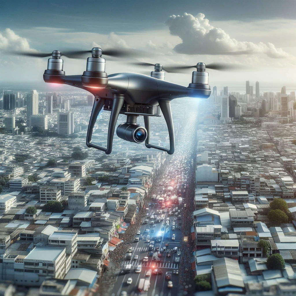
AI-powered drones with computer vision contribute significantly to smart city initiatives. They are used for goods delivery, traffic control, natural disaster monitoring, and crowd management. For instance, companies like Amazon and FedEx employ autonomous drones for package delivery, a market projected to reach $32.1 billion by 2031. These drones also aid authorities in managing traffic and monitoring public events, enhancing city safety and efficiency.
How Are Drones Utilized in Construction and Infrastructure Monitoring?
In construction, drones monitor project progress, identify safety hazards, and track materials on sites. They quickly capture large amounts of aerial data, offering insights for better project management. For example, drones in construction are expected to see a spending of over $11.2 billion in the next five years, highlighting their growing importance in improving efficiency and safety in the construction industry.
What Advances in Computer Vision Are Enhancing Drone Surveillance and Security?
Advances in computer vision enable drones to effectively perform surveillance and security tasks. They analyze visual data to identify suspicious activities, unauthorized access, and enhance threat detection. For example, drones equipped with computer vision sensors are crucial in military intelligence, gathering real-time visual data for threat identification and reconnaissance missions, thus improving decision-making and mission success rates.
How Is Computer Vision Technology Paving the Way for Autonomous Drone Navigation?
Computer vision technology is pivotal in developing autonomous navigation and obstacle avoidance in drones. It allows drones to perceive their surroundings, enabling autonomous flight and collision avoidance. In industrial inspections and military operations, computer vision algorithms enable drones to navigate hazardous environments without human intervention, reducing risks and enhancing mission success. This autonomous capability is crucial for operations in dense forests, mountainous regions, or urban settings.